3D laser scanning measurement technology overcomes the shortcomings of low efficiency, large information loss and difficult promotion of professionalism of traditional measurement technology. It can scan any object, quickly and efficiently convert the environmental information of the real world into easy to process data, and restore the real social environment to the greatest extent. It has the characteristics of rich information, intuitive and visual, easy to use and strong expansibility. Here’s everything about 3D laser scanner in building elevation measurement.
3D Laser Scanner in Building Elevation Measurement
In the field of building facade measurement, the emergence and development of three-dimensional laser scanning measurement technology overcomes the limitations of traditional building facade measurement. It is no longer a measurement mode of building length, width and height using simple tools such as tape measure and rangefinder, but an efficient measurement mode that can scan buildings without contact, quickly and accurately, and quickly convert the obtained point cloud information into data that can be processed by computer. It solves the problems of accuracy loss and efficiency loss caused by manual collection of building facade data, especially the problem that the facade elements of high-rise buildings cannot be measured.
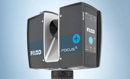
Equipment introduction
Faro focus 350 3D laser scanner can accurately and quickly obtain the point cloud, 976000 points / s constitute a millimeter level 3D image system, and the distance error is 1mm. The instrument operation interface is Chinese touch panel, which can be used directly without external cable or notebook. Built in integrated color camera, scanning data is stored in memory card, and the volume of 24 * 20 * 10cm is more convenient for work.
The main parameters are as follows:
– Scanning distance: 0.6-350m.
– Measuring speed: 122000 / 244000 / 488000 / 976000 (point / s).
– Ranging error: ± 1mm.
– Angular accuracy: 19 arcsec (vertical right angle / horizontal angle).
– Three dimensional position accuracy: 10M: 2mm / 25m: 3.5mm
– Resolution: up to 165 megapixels, color.
– High dynamic range (HDR): exposure 2x, 3x, 5x.
– Parallax: coaxial design, no parallax.
– Weight (including battery): 4.2 kg.
– Size: 230x183x103 mm.
Control survey and station layout
Relative positioning and absolute positioning are adopted for the specific situation of the field control visual measurement area of ground 3D laser scanning. The field survey area is the area with dense urban buildings.
– According to the GPS signal, the operation control survey can be carried out by setting control points on the periphery and sub stations on the inside.The layout of ground 3D laser scanning operation survey stations shall be able to fully cover the survey area, and the distance between stations shall ensure a certain degree of point cloud overlap. As the buildings are dense and the gap between buildings is very small, the scanning operation adopts the method of setting survey stations at four corners of the building.
– According to the spatial location relationship of urban buildings, scanning stations can survey in advance to obtain the ideal station location, so as to ensure the overlap of data point clouds in the later stage.
Data acquisition scan
Faro focus 350 3D laser scanner can quickly obtain 3D point cloud data of high-rise buildings. You can use the drawing software to draw the building elevation directly on the point cloud data. Faro 3D scanning solution can quickly, accurately and efficiently capture the color of components and objects in the real world into the modeling software.
Conclusion
The emergence and engineering application of ground 3D laser scanner will change the traditional surveying and mapping operation mode and improve the operation efficiency. The laser point cloud data collected by the ground 3D laser scanner can not only be used in the field of elevation surveying and mapping, but also in the fields of building 3D modeling, urban sunshine analysis and so on. It is believed that with the development of technology and the improvement of specifications, the ground laser scanner will play an increasingly important role in the field of Surveying and mapping. The workstation is born for special application needs, such as professional graphics processing, three-dimensional design, rendering, etc. industrial manufacturing industry has become the main battlefield of the workstation because of the need for more complex product design.