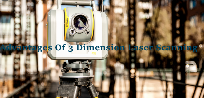
In the surveying and mapping industry, 3D laser scanning or actual scene reproduction technology is a technical breakthrough after GPS. For the first time ever, it breaks beyond the standard single-point measuring technique and possesses the unique benefits of efficiency and accuracy. As a result of 3D laser scanning technology, high-precision and high-resolution digital landscape models may be created. Here is everything you should know about the working process and the advantages of 3D laser scanning.
The Working Process Of 3D Laser Scanning
In recent years, three-dimensional laser scanning technology has become more popular in China’s scientific community. For example, it may rapidly create a three-dimensional model of the measured item and different map data such as line (surface), surface (volume), and volume based on the three-dimensional coordinates of dense spots on the surface. When it comes to 3D laser scanning technology, it is often referred to as a technological advance from single point measurements to surface measurements because of its ability to acquire a high number of data points.
As well as in the fields of cultural relics and historic sites protection and architecture and planning as well as civil engineering and factory transformation and interior design and building monitoring and traffic accident treatment and legal evidence collection and disaster assessment and ship design and military analysis. Laser scanning systems comprise both the hardware and software components for acquiring and processing 3D data. A three-dimensional laser scanning system may be classified as either airborne, vehicle-mounted, or ground-mounted depending on the carrier.
Measurement of the workpiece is done using scanning technology. It is used mostly in reverse engineering for surface reading and 3D measuring of workpieces. When there are no technical papers for an existing 3D item (sample or model), the software may swiftly measure and edit and adjust its contour collecting data before generating a surface digital model.
The Advantages Of 3D Laser Scanning
The benefits of three-dimensional laser scanning technology include high accuracy, high speed, high resolution, non-contact, and strong interoperability with other technologies. “Another technical breakthrough in the area of Surveying and mapping following GPS technology.” According to an analogous study with classic surveying methods, such as the total station, near range photogrammetry, and aerial photogrammetry:
1.Non-interaction.
Three-dimensional laser tracing uses a non-contact high-speed laser measuring technique that directly tracks the target without reflecting prisms and gathers the dimensional coordinate information of the target’s surface points. It is impossible to use typical measuring techniques when the objective is unsafe, contaminated, or inaccessible. A three-dimensional laser scanning system has apparent advantages now.
2. A high level of digitalization and a high degree of expansion.
Because the three-dimensional laser 1 tracing system collects data as digital signals with all of their digital properties, the post-processing software’s user interface is simple and intuitive to work with. Data may be exchanged and shared with other commonly used programs using this protocol. An external digital camera and GPS may be utilized to expand its application range and have a high degree of extensibility with this product.
3. High-definition video.
In order to obtain high resolution, 3D laser tracking technology is capable of quickly, high-quality, and high-density capture of three-dimensional data.
4. A wide range of uses and a high degree of flexibility.
Because of its excellent technical qualities, low service needs, great environmental adaptability, and ability to be employed in the field, it is extensively used in a broad range of engineering construction applications.
Why Should We Use 3D Laser Scanning?
The goal of virtual reality is to generate lifelike 3D settings and objects as possible using a specific set of software and equipment. The most important component in virtual simulation is the realism of the sceneries and objects. During the 1990s, virtual reality (VR) developed as a new, all-encompassing tool for information. These include digital image processing and computer graphics as well as multimedia technology and sensor technology. 3D vertical scanning technology was also developed at the same time.
It is becoming more clear that the bottleneck of actual data collecting and precise modeling in the real world is substantially limiting the advancement of virtual reality technologies. Virtual reality and real-world scenes may now be created using 3D stereo scanning technology, which completely overcomes the issue of data collecting.
3D laser scanning differs from conventional surveying and mapping technology in numerous ways (because there are many and enough traditional high-precision surveying and mapping technologies). Reverse three-dimensional modeling and reconstruction are its primary uses. Surveying and mapping technology relies on the capture of a huge number of Surveying and mapping points, at least tens of thousands, if not millions, in order to describe the whole features of the target structure, which cannot be done with a single point precise measurement. As a result, new high-precision sensor technologies may help resolve this issue. This form of automated high-precision three-dimensional scanning technology is referred to as three-dimensional laser scanning.
Scanners that use 3D laser scanning have a plethora of uses. It’s a reverse modeling technique since it’s the asymmetrical application of forwarding modeling (such as the manual operation of CATIA, UG, and CAD) (such as directly restoring the model from the entity or real scene).
Analysis of structural characteristics (such as deformation, stress, efficiency; process; attitude; prediction; etc.) can be performed using reverse modeling, which can then be used for various structural characteristic analyses (such as detection; simulation; CIMS; CMMs; virtual reality; flexible manufacturing; etc.). It is critical to use software that analyzes engineering mechanics, hydrodynamics, and more. Post-processing, mapping, and measuring may also be used for work that requires a high degree of precision.
The surface structure is just one of many attributes of spatial data that will continue to grow in importance as the field expands to include environmental quantification, virtual manufacturing, flexible manufacturing, tooling technology, workpiece combination, digital factory, and process operation as well as visual simulation and virtual reality applications. As part of this expansion, the social horizontal application will also be extended.
If youa are interested in any qualiy inspection service, Ipqcco.com is always the best choice!