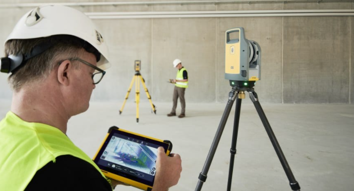
The final embodiment of computer vision is three-dimensional vision, and the expression of three-dimensional vision is a point cloud. Point cloud processing plays a very important role in the whole field of three-dimensional vision, which involves almost all related fields, such as automatic driving perception and positioning, slam, three-dimensional scene reconstruction, AR / VR, SFM, pose estimation, three-dimensional recognition, structured light, stereo vision, three-dimensional measurement, visual guidance, etc.
What Is The 3D Laser Point Cloud Data Processing Software?
In recent years, both academia and industry have begun to gradually shift their attention to point cloud work. The applications related to it have an explosive trend, and the demand for corresponding posts is much greater than the supply. Subsequently, enterprises do not hesitate to pay a lot of money to recruit engineers related to point cloud processing algorithms. Today, we are going to find out what is the 3D laser point cloud data processing software.
1. Rhinopoints
The system is based on the famous surface modeling master rhinoceros platform. Rhinoceros has more than 20 years of mature market practical experience. It is a rare excellent 3D modeling system in the industry. It has powerful functions such as sufficiently perfect 3D modeling, effect rendering, parametric modeling, and so on! With the support of the platform, the system can load unlimited point cloud data into the drawing environment. The application process is extremely smooth and there is no problem of jamming.
The system has rich adjustment functions of point cloud data display mode, powerful and convenient point cloud slicing function, flexible and efficient point cloud cutting, blocking and grouping functions, and accurate point cloud capture function It is widely used in underground building modeling, 3D modeling of underground buildings, 3D modeling of buildings based on cloud, 3D modeling of buildings based on 3D camera, 3D modeling of buildings based on 3D camera, 3D modeling of buildings based on 3D camera, etc
The system has the powerful function of loading unlimited point cloud data in real-time based on LAN or WAN. Users do not need to store a large number of point clouds on the local computer, but can also directly load the data content on the remote computer. Effectively solve the time consumption problem of TB huge point cloud data transmission through network disk or mobile hard disk, and effectively solve the data distribution problem of a large amount of data in multi-person teamwork projects.
2. Datafactory
Based on 3D digital earth, the system is a 3DGIS platform for data carrying, browsing and information comprehensive management. It can load an unlimited amount of point cloud data, build a spatial scene with point cloud data, and overlay other data contents with rich types in the scene. The data types that the system can load are as follows: 3D model, plane photo, panoramic photo, DEM digital elevation model, DSM digital surface model, ESRI shap file, CAD 2D line drawing, personnel perspective, hyperlink, text annotation, audio, ambient sound, webcam, etc… the digital earth can be set with transparent effect, which is suitable for carrying underground space information, such as underground pipe gallery, mine roadway, subway tunnel Underground garage, etc
The system has the function of time attribute, which can define time attributes for almost all types of data content mentioned above, and deepen the management of spatial geographic information elements through time elements, so as to perfectly overlap the 3DGIS platform with the time axis.
The system supports VR browsing of all scene information. Point cloud VR is the unique function of the system. It supports the browsing of VR mode spatial location information of great scenes, provides accurate browsing of early planning effect for the field of BIM design and construction, and visually superimposes the unfinished scenes with the actual scenes.
The system has the function of 4K ultra-clear animation production and output and can provide users with excellent visual effects and achievement display animation. Animation production is powerful and easy to operate.
The system can load the point cloud data on remote computing based on LAN or WAN, or all the data content that can be loaded by the platform, so as to realize the online publishing, browsing, and sharing of 3DGIS information.
The system is suitable for the display and reporting of 3D laser scanning or tilt photogrammetry results in large scenes and avoids the problem that it is difficult to complete the project report or data information management due to a large amount of data. It is also applicable to overlay the design concept with the current situation of the actual site, so as to provide data platform support for the discussion and deliberation of the planning and design scheme.
3. Cloud server
The system has the characteristics of powerful function and simple operation. Its main function is to publish unlimited point cloud data to LAN or WAN, so that point cloud data can be accessed smoothly based on computer and mobile terminals (mobile phone, pad, tablet).
If only to meet the needs of data browsing, there is no need to install any professional software on the computer or mobile terminal. You can directly view unlimited point cloud data by opening the data access link through the IE browser. It is applicable to the application of project schedule management, digital chemical engineering, on-site emergency command of geological disaster, scene browsing, project results reporting and display, etc. it does not need to have professional technical level, as long as you can use the browser to surf the Internet, which is convenient for non-technical leaders.
In order to meet the professional application, the point cloud data released by the system can be used by rhino prints and data factory professional software for real-time online application of remote point cloud data to solve the problems of data transmission, storage, and distribution.
The system has the characteristics of powerful function and simple operation. Its main function is to publish unlimited point cloud data to LAN or WAN, so that point cloud data can be accessed smoothly based on computer and mobile terminals (mobile phone, pad, and tablet).
4. Pointfactory
If you want to easily and efficiently complete several major links of point cloud data processing (splicing filtering modeling result extraction), this system is an excellent choice. For point cloud applications such as topographic mapping, mine survey, earthwork calculation, land leveling, geology, and geotechnical engineering, landslide monitoring, engineering Bim and lidar data processing, it is competent and excellent.
This system has the following advantages:
One-stop to the end
From data preprocessing to result in output, all work is completed in the same software without transmitting data between multiple sets of software, which can reduce the time waste caused by data import and export, so as to greatly improve your work efficiency!
Flexible and easy to use
The exquisite design of multiple view functions provides convenience for all links of point cloud data processing, making the whole data processing process easy to control.
Professional integration
The results meet the professional needs of applications in various industries, and there is no need for secondary processing of the results to reduce unnecessary workload.
Process customization
You can customize the exclusive operation process according to your daily application habits, so as to simplify the operation and reduce the possibility of misoperation.